The realm of laser scanners offers a fascinating insight into how technology has evolved to measure and map the physical world with extreme precision. These devices play a critical role in industries like construction, engineering, and architecture by capturing millions of data points in real-time to generate accurate 3D models and virtual twins of objects or environments. The ability to measure exact dimensions and calculate spatial data enables professionals to make informed decisions and streamline complex projects. So, what exactly is a laser scanner, and how does it function?
Understanding Laser Scanners
At its core, a laser scanner is a sophisticated device that captures three-dimensional information by emitting a laser beam that measures an object’s surface. The beam reflects off the object and returns to the scanner, allowing it to calculate the distance between the scanner and the object. This process is repeated millions of times per second, mapping the object in fine detail. The data collected is used to build a digital replica or virtual twin, essential in fields requiring precise measurements.
The Evolution of Laser Scanning Technology
The history of laser scanners dates back to the early 1960s when physicist Gordon Gould conceptualized the laser beam for measuring distances. However, it wasn’t until the 1970s and 1980s that laser scanning devices began to see wider application, initially in scientific and military projects. By the 1990s, the technology became more refined, with advancements in point-cloud capture and software that allowed more complex data processing. This evolution paved the way for industries like construction and architecture to adopt laser scanning for real-world projects.
Benefits of Using Laser Scanners
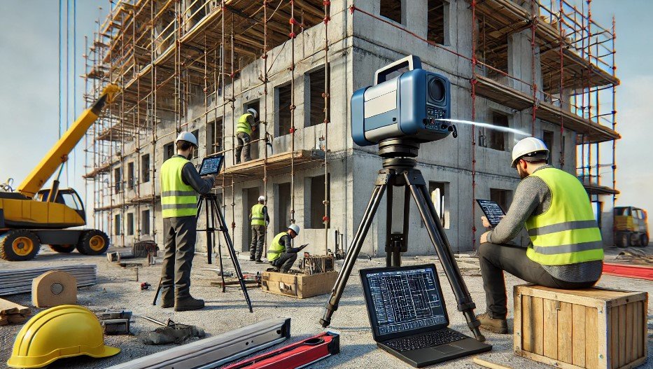
One of the primary advantages of laser scanners is their ability to deliver highly accurate 3D models, aiding in project planning and management. Engineers can rely on the data to inspect structures, architects can design around existing frameworks, and project managers can track progress with unparalleled precision. The ability to create digital twins in real-time also allows for rapid decision-making, which is especially useful in dynamic environments like construction sites or during infrastructure assessments.
In addition, laser scanners detect even the smallest changes in an environment, which is crucial when monitoring critical structures such as bridges, tunnels, or historical landmarks. By identifying minute shifts, stakeholders can take preventative measures before issues become significant problems.
How Laser Scanners Operate: Basic Principles
Laser scanners operate by projecting a laser beam onto the target object. The light reflects back to the scanner, and the device calculates the “time of flight” (TOF), or the time it takes for the laser to return. This TOF correlates directly with the distance between the scanner and the object, allowing precise spatial data to be captured. Over time, the scanner emits millions of beams, creating a comprehensive 3D map of the target area.
Types of Laser Scanners and Their Technologies
There are several types of laser scanners, each suited to different purposes. One of the most common is the triangulation laser scanner, which uses a reflector and sensor to measure distance. While highly accurate, this scanner may be affected by environmental lighting. Another type is the LiDAR scanner, which uses pulsed light to create detailed 3D maps of large areas. This method is especially useful for large-scale projects like surveying forests or mapping terrains.
Finally, time-of-flight scanners capture distance by measuring how long it takes for the light pulse to return to the scanner. Each of these technologies has its own advantages and limitations, and the choice depends on the project’s complexity and scope.
Practical Applications of Laser Scanning Technology
The versatility of laser scanners is evident in their wide-ranging applications. In construction, they create accurate models of buildings, infrastructures, and equipment, allowing professionals to plan and execute projects with greater efficiency. Architects can use them to assess existing structures or design buildings with precision based on real-world data.
In the engineering sector, laser scanners are used to document and inspect critical infrastructures such as bridges, tunnels, and industrial facilities. This documentation is invaluable for ensuring safety, assessing structural integrity, and planning maintenance. The technology has also found applications in mining, where it helps create 3D models of mineral deposits for better extraction planning.
Additionally, laser scanners play a crucial role in quality control within manufacturing, identifying defects in production lines, and ensuring that products meet exact specifications. They are equally useful in logistics, where they help map warehouses and streamline operations.
Limitations and Challenges of Laser Scanning
Despite their many advantages, laser scanners also come with certain limitations. For example, they can struggle to capture accurate data in low-light conditions or environments with reflective surfaces. Shadows, obstacles, and even weather conditions such as fog or rain can interfere with data collection, reducing the scanner’s accuracy.
In terms of software, aligning and stitching multiple scans together can be a complex task that requires specialized skills. Additionally, the high cost of advanced scanners can make them inaccessible for smaller businesses, posing a challenge for widespread adoption.
Free Revit families now on Bimshares.com


